Half Skyline
The Participant guide includes links to the GPX files. [guide updated 15th July 2023]
Download participant guide
The event HQ is at Buxton Community School. This venue features a large car park, as well as post-race shower and change facilities. From 2018, there will be two courses. The usual full distance 29.5-mile with 2000m elevation , and also a 14.5-mile Half-Skyline with 900m of elevation.
The events each have an 7-hour (for the half, average 2.2mph) or 8-hour cut-off, (for the 50k – average of 3.7mph). Also, each of the three manned checkpoints (one CP on the half) has interim cut-off times which are also timed at 3.7mph (50k runners), though barely making 3.7mph at CP1 will almost certainly result in missing the cut at CP2 or CP3.
8 hours is a generous time limit, but means that it is you cannot walk much of the course. If you don’t think you are quite up to that average speed, or you are relatively new to trail running then you should take on the Half which is still very challenging, and has a time limit of 7 hours.
If you take on the full distance and do not make any cut-off, we will retire you from the course and bring you back for some early tea and cake! There are no medals for starting the Full, and dropping to the Half!
The route begins with an immediate ascent to Solomon’s Temple (SHuSh on the South side of Back Forest above Lud’s Church (a natural chasm), before turning North into Gradbach Woods. Descend further to the River Dane and reach the next manned checkpoint and refreshment station (CP2) nr Gradbach scout camp.
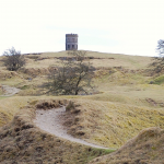
Now, climb out of the river valley to Burntcliff Top, and enjoy relatively easy 4×4 trail for 1.5km. Don’t get too comfortable as you will see The Peak District Matterhorn; Shutlingsloe ahead of you. The ascent of Shutlingsloe gets more severe as you reach the top, with a little scrambling required to gain the summit and claim trig point number three.
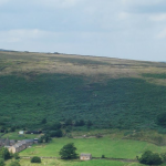
You descend Shutlingsloe on the same path initially, before heading North to Cumberland Cottage and a narrow technical ascent alongside the brook, up the re-entrant Danethorn Holllow to join the Main Danebower Hollow Path to the next manned refreshment point (CP3), opposite the well known Peak District landmark and 2nd highest pub in England; The Cat and Fiddle. It’s a 1.5 mile ascent of Shining Tor to the trig point four.
After Shining Tor, enjoy the rough but fast Stake-side descent through Stake Clough and Deep Clough to reach the Goyt Valley floor. The final ascent is Goyt’s Moss, on a narrow path moorland to reach Burbage Edge, passing about 200m from the 5th trig point. Then all that’s left is a descent into Burbage and Buxton back to the school to reach the finish line.
The course has 2000m of elevation, which is 42m elevation per km. For comparison Grand Race Les Templiers (one of Frances most prestigious Trail races) has 46m per km, and the UK’s Lakeland 50 has 39m of elevation per km (over 50 miles). So, expect a tough day out in the Peak District! 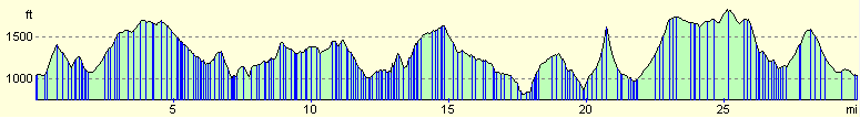
-
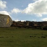
- Solomon’s Tower
-
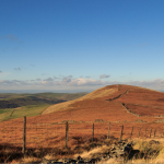
- Axe Edge Moor
-
- Roaches January
-

- Ramshaw Rocks
-
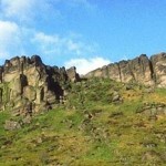
- Hen Cloud
-

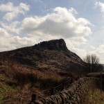
- Shutlingsloe
-
- Shining Tor summit
-
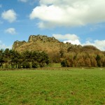
- Hen Cloud
-
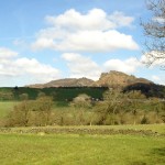
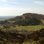
- The Roaches and Hen Cloud
-
- The Roaches
-
- The Roaches
-
- Hen Cloud
![]()
![]()